
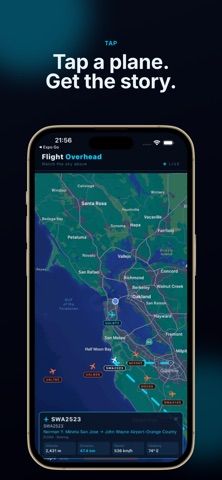
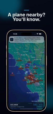
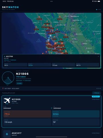
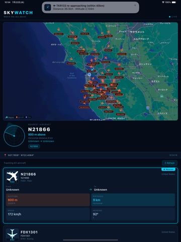
Flight Overhead answers a simple aviation question: what aircraft is flying above this location? The app uses the device's position to find nearby aircraft and show their live map positions and headings. Tap a plane to view its flight number, altitude, speed, and route when data is available; aircraft silhouettes and departure or arrival airports provide additional context. Users can highlight the nearest aircraft and set a radius for notifications when a plane approaches. The developer says aircraft positions come from the OpenSky Network and refresh about every 15 seconds, while route and type details use public databases. The App Store lists a free download, but the description does not specify optional purchase terms or exact coverage. Data availability can vary, and this is an aircraft information tool rather than an air-traffic control source.

Flight Overhead
An aircraft-overhead tracker that uses location to show nearby planes, flight details, routes, and approach alerts.
Overview
A closer look at Flight Overhead.
A closer look
App screenshots
Choose with confidence
The useful details.
What it does
- Detect aircraft near the user's location and show them on a map
- View available flight number, altitude, speed, and route details
- Highlight the nearest aircraft and inspect aircraft silhouettes
- Set a radius alert for approaching aircraft
A good fit for
- Aviation enthusiasts curious about planes overhead
- People near airports who want a quick view of nearby aircraft
Worth knowing
- Aircraft and route data depend on public data coverage and refresh intervals; the listing does not specify optional purchase terms.
Frequently asked questions
Answers based on the app’s official listing and reviewed information.
What is Flight Overhead used for?
An aircraft-overhead tracker that uses location to show nearby planes, flight details, routes, and approach alerts.
What can you do with Flight Overhead?
Detect aircraft near the user's location and show them on a map View available flight number, altitude, speed, and route details Highlight the nearest aircraft and inspect aircraft silhouettes Set a radius alert for approaching aircraft
Who is Flight Overhead designed for?
Aviation enthusiasts curious about planes overhead People near airports who want a quick view of nearby aircraft
What should you know before downloading Flight Overhead?
Aircraft and route data depend on public data coverage and refresh intervals; the listing does not specify optional purchase terms.
Does Flight Overhead include paid features?
The US App Store lists a free download.
Which platforms support Flight Overhead?
Greatooly's reviewed app information lists iOS.
Researched from official sources; this is not a hands-on review. Last checked 2026-11-04.
Keep exploring
More apps that might be a good fit.

Tripdrobe: Outfit Packing List
Plan outfits and packing lists by trip date, with premium weather, baggage, wardrobe, and group tools.

SkyFlight Tracker
A flight companion with live status, gate countdowns, route maps, layover risk alerts, airport weather, and travel statistics.
FLITx・Live Flight Tracker Map
A live flight map for searching aircraft and routes, checking flight status, and viewing nearby airport activity.