
Hiker is a lightweight topographic map built for outdoor trips where mobile coverage may disappear. Download a region before leaving Wi-Fi, then use vector map data, elevation contour lines, shaded relief, and the phone's GPS position while offline. These layers help hikers understand terrain and see nearby features without streaming a map. The developer says there is no account, advertising, or tracking, and that location stays on the device. The app is intended to stay focused on maps; the listing does not describe turn-by-turn navigation, route recording, emergency communications, or a comprehensive trail directory. Map data is attributed to OpenStreetMap contributors. Download maps in advance, check the area's coverage and terrain, and carry appropriate offline safety resources for the route.

Hiker: Offline Trail Maps
An offline topographic map for hikers, with downloadable regions, elevation contours, hillshade, and on-device GPS.
Overview
A closer look at Hiker: Offline Trail Maps.
A closer look
App screenshots
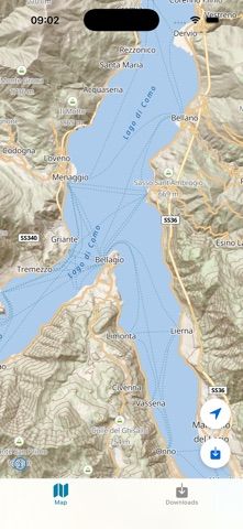
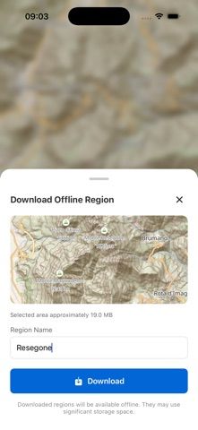

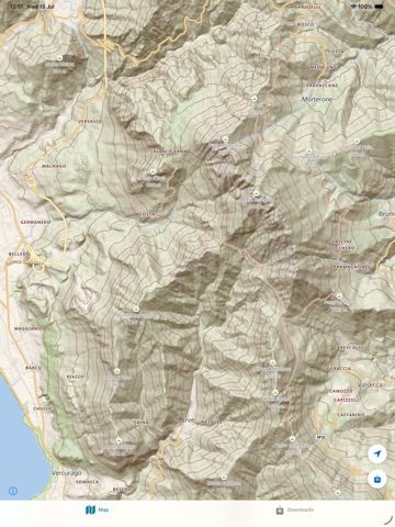
Choose with confidence
The useful details.
What it does
- Download map regions for offline use
- View elevation contour lines and shaded terrain
- Show the device's live GPS position without a network connection
- Use lightweight vector maps with no account, ads, or tracking according to the developer
A good fit for
- Hikers who want a topographic map available beyond cell coverage
- Outdoor users who prefer downloading map regions before a trip
Worth knowing
- The listing does not describe turn-by-turn routing or a trail catalog; download maps before losing connectivity and verify local coverage.
Frequently asked questions
Answers based on the app’s official listing and reviewed information.
What is Hiker: Offline Trail Maps used for?
An offline topographic map for hikers, with downloadable regions, elevation contours, hillshade, and on-device GPS.
What can you do with Hiker: Offline Trail Maps?
Download map regions for offline use View elevation contour lines and shaded terrain Show the device's live GPS position without a network connection Use lightweight vector maps with no account, ads, or tracking according to the developer
Who is Hiker: Offline Trail Maps designed for?
Hikers who want a topographic map available beyond cell coverage Outdoor users who prefer downloading map regions before a trip
What should you know before downloading Hiker: Offline Trail Maps?
The listing does not describe turn-by-turn routing or a trail catalog; download maps before losing connectivity and verify local coverage.
Does Hiker: Offline Trail Maps include paid features?
The US App Store lists a free download.
Which platforms support Hiker: Offline Trail Maps?
Greatooly's reviewed app information lists iOS.
Researched from official sources; this is not a hands-on review. Last checked 2026-11-04.
Keep exploring
More apps that might be a good fit.

Tripdrobe: Outfit Packing List
Plan outfits and packing lists by trip date, with premium weather, baggage, wardrobe, and group tools.

SkyFlight Tracker
A flight companion with live status, gate countdowns, route maps, layover risk alerts, airport weather, and travel statistics.

FLITx・Live Flight Tracker Map
A live flight map for searching aircraft and routes, checking flight status, and viewing nearby airport activity.