
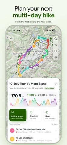
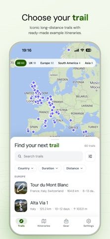
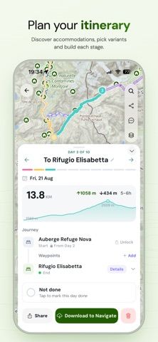
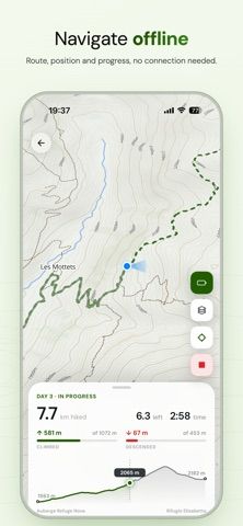
Traileasy is a planner and offline navigator for multi-day hikes, including hut-to-hut treks and long-distance trails. Build a day-by-day route on a topographic map and compare stage distance, estimated hiking time, ascent, and descent. Overnight huts, refuges, hotels, bed-and-breakfasts, and campsites can be shown along the planned route, and stages can be exported as GPX files. Download a trip before leaving coverage to keep maps, water sources, elevation information, and planned stays available offline. A gear list with base-weight tracking helps organize packing, while completed hiking days can be saved with their route and stats. Traileasy covers named trails in several European regions; check route access, weather, and local conditions with official sources before setting out. The listing does not state current pricing.

Traileasy: Multi-Day Hiking
Traileasy plans multi-day hikes with stage routes, elevation profiles, overnight stays, offline topographic maps, and GPS navigation. It supports GPX stage export, packing lists with base-weight estimates, and saved hike records. It is designed for long-distance routes and hut-to-hut treks; current pricing is not specified in the listing.
Overview
A closer look at Traileasy: Multi-Day Hiking.
A closer look
App screenshots
Choose with confidence
The useful details.
What it does
- Stage-by-stage route planning with distance and elevation profiles
- Offline topographic maps and GPS navigation
- Overnight stay and water-source information along a route
- GPX export, gear lists, and saved hike statistics
A good fit for
- Hikers planning hut-to-hut or long-distance multi-day routes
- People who want offline maps and a stage-based itinerary
Worth knowing
- Coverage is trail- and region-dependent; verify access, weather, and conditions with official sources. Pricing is not specified.
Frequently asked questions
Answers based on the app’s official listing and reviewed information.
What is Traileasy: Multi-Day Hiking used for?
Traileasy plans multi-day hikes with stage routes, elevation profiles, overnight stays, offline topographic maps, and GPS navigation. It supports GPX stage export, packing lists with base-weight estimates, and saved hike records. It is designed for long-distance routes and hut-to-hut treks; current pricing is not specified in the listing.
What can you do with Traileasy: Multi-Day Hiking?
Stage-by-stage route planning with distance and elevation profiles Offline topographic maps and GPS navigation Overnight stay and water-source information along a route GPX export, gear lists, and saved hike statistics
Who is Traileasy: Multi-Day Hiking designed for?
Hikers planning hut-to-hut or long-distance multi-day routes People who want offline maps and a stage-based itinerary
What should you know before downloading Traileasy: Multi-Day Hiking?
Coverage is trail- and region-dependent; verify access, weather, and conditions with official sources. Pricing is not specified.
Does Traileasy: Multi-Day Hiking include paid features?
The reviewed listing does not confirm current in-app purchase options.
Which platforms support Traileasy: Multi-Day Hiking?
Greatooly's reviewed app information lists iOS.
Researched from official sources; this is not a hands-on review. Last checked 2026-11-04.
Keep exploring
More apps that might be a good fit.

Tripdrobe: Outfit Packing List
Plan outfits and packing lists by trip date, with premium weather, baggage, wardrobe, and group tools.

SkyFlight Tracker
A flight companion with live status, gate countdowns, route maps, layover risk alerts, airport weather, and travel statistics.

FLITx・Live Flight Tracker Map
A live flight map for searching aircraft and routes, checking flight status, and viewing nearby airport activity.